


NOAA Tide Chart & Forecast
3.847.00 Reviews
App Specs
- Version
- 2.7.6.63
- Updated On
- License
- Free
- Downloads
- 10,000+
- Developer
- NextStack LLC
- Categories
- Weather
- Platform
- Android
Screenshots
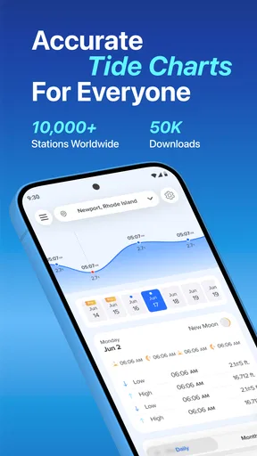
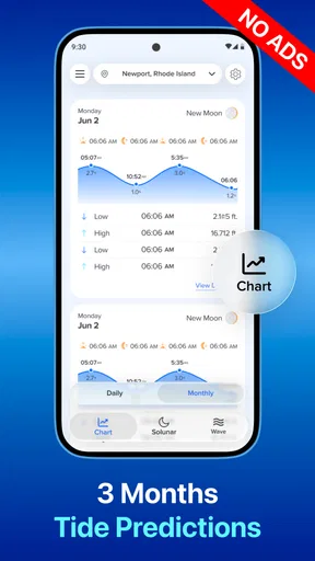
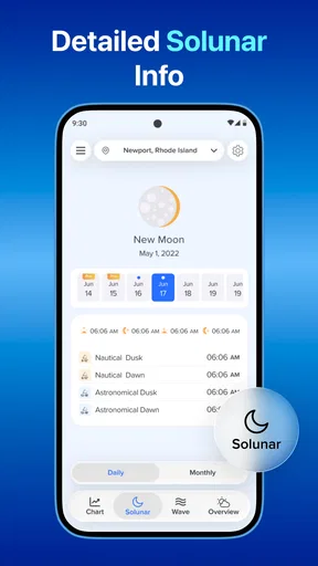
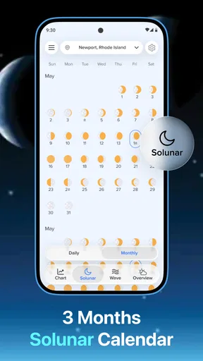
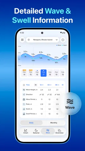
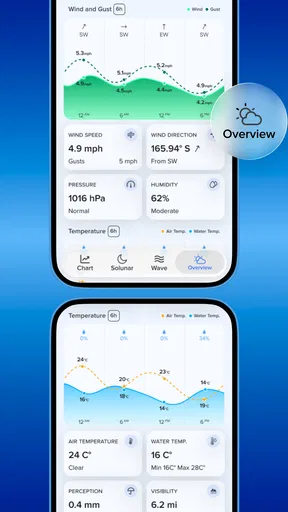
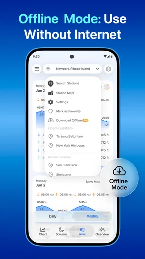
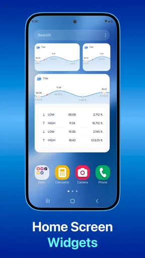
 Analysis by AppCompare
When I plan time near the coast, I do not need another general weather screen telling me only whether the day looks sunny. I need to know when the water will rise, when it will fall, and whether the useful part of the day lines up with those changes. That is where NOAA Tide Chart & Forecast earns its place. It is a free weather app from NextStack LLC built around tide information, with real-time readings, forecasts, predictions, and a long-range view reaching ninety days.
After using it as a tide-planning tool rather than as a complete replacement for a normal weather service, I found its main value quite clear: it turns an otherwise easy-to-miss coastal pattern into something I can check before leaving home. The app is not trying to be a full marine navigation system or a detailed storm-monitoring dashboard. Its strength is narrower and more practical. If the timing of high and low water affects your plans, the focused layout can save you from guessing.
Why the tide view matters more than a simple weather forecast
A standard weather app can tell me about rain, temperature, wind, or cloud cover, but those details do not answer the question I often have at a beach, harbor, estuary, or tidal river: will the water be where I need it to be when I arrive? A low tide can expose a broad walking route, uncover rocks, change access to a small boat, or make a fishing spot much less useful. A high tide can do the opposite.
The central capability here is the combination of current tide information with future tide predictions. That matters because a tide is not a vague condition like “partly cloudy.” It is a schedule. I can look beyond the next few hours and compare the water cycle with a planned outing, which is much more useful than opening a general forecast only on the morning itself.
The ninety-day tracking window is especially helpful for plans that are more deliberate than a spontaneous beach visit. I can think about a weekend walk, a photography trip, a shoreline cleanup, or a recurring fishing routine without checking the app from scratch every day. The longer view does not remove the need to check immediate weather conditions, but it gives me a sensible first filter: is the tide timing even compatible with the activity?
That distinction is important. A tide prediction can help me choose a time, but it cannot tell me whether the path will be slippery, whether waves will be dangerous, or whether a storm has changed local conditions. I use the app to answer the water-level question first, then I use a broader forecast and local safety information for everything else.
Reading the information without overcomplicating it
The app’s appeal is that I do not have to translate a general weather forecast into a tide schedule myself. I can focus on the sequence of rising and falling water and use that sequence to make a decision. For someone who regularly visits the same coastal area, this is a more direct workflow than searching online for a tide table every time.
Worth Reading Before You Choose

Flipboard Shows What News Apps Must Do Beyond the Feed

Switching to Android Auto Means Rethinking Your Driving Routine

Google Calendar Makes a Crowded Week Easier to Manage

Ludo King Makes the Most of the Minutes Between Plans

Baby Panda World Brings Quick Play to Modern Phones, but Its Game Library Feels Busy

ESPN’s Live Game View Makes Following Close Games Easier
Real-time information is useful when I am already near the water and want to compare the expected stage of the tide with what I can see. Forecasts and predictions are more useful before I leave. I treat those functions as related but not identical: the immediate view supports a quick check, while the longer forecast supports planning.
One practical habit I developed is to check the tide before deciding on the route, not after. A shoreline path that looks perfect on a map may become awkward or inaccessible as the water rises. Looking at the tide first lets me choose whether to walk near the water, stay on a higher trail, or visit at a different time. This is a small change in routine, but it is the kind of benefit a short store description does not explain.
I also recommend checking the time rather than relying only on the label of high or low tide. The useful moment for an activity may occur before or after the official turning point. For example, a person photographing exposed rocks may want to arrive early enough to set up, while someone launching a small craft may need enough water before the exact high point. The app gives me the schedule; I still have to apply it to the real place and activity.
A realistic day using the app
Imagine I am planning a morning walk along a tidal shoreline. I open the app the evening before and look at the next day’s tide pattern. If the lowest water occurs after the time I intended to start, I can either delay the walk or choose a route that does not depend on exposed shoreline. If the water is already rising during my preferred window, I know I should not treat a narrow beach section as a fixed route.
On the morning itself, I can check the current information again before leaving. That second look does not replace common sense, but it helps confirm that my plan still matches the expected cycle. Once I arrive, I pay attention to actual conditions, access points, waves, and other people using the area. The useful lesson is that the app works best as part of a short planning routine: check the tide, check the weather, then make a conservative decision.
The same process works for fishing. Instead of arriving at an arbitrary hour, I can choose a period around the tide movement that suits the location and the type of fishing I intend to do. I would not assume the app can predict whether fish will be active, because that depends on far more than water level. Its role is to remove one layer of uncertainty from the schedule.
For photography, the benefit is even more obvious. Low water can reveal textures, pools, sand patterns, and rocks that disappear later. A long-range view helps me identify promising dates, while the nearer forecast helps me decide whether the light and weather make the trip worthwhile. This is one of the strongest uses because the tide itself is part of the subject, not merely a logistical detail.
Where the long-range view helps—and where it stops helping
Planning ninety days ahead sounds powerful, but I use that horizon as a planning aid rather than a guarantee. It is excellent for spotting broad timing opportunities, comparing weekends, and organizing repeat visits. It is not a reason to ignore the short-term forecast or local warnings when the date approaches.
This creates a useful two-stage workflow. First, I use the long view to avoid choosing a date that is obviously unsuitable for the activity. Later, I return to the app for the nearer tide prediction and combine it with current weather information. That approach keeps the feature practical instead of encouraging false confidence in a distant prediction.
Another non-obvious benefit is that the long view can help with coordination. If several people are meeting for a shoreline activity, I can choose a tide window that gives everyone a reasonable arrival and departure period. That is better than selecting a date based only on everyone’s calendar and discovering that the water conditions make the planned activity awkward.
Trade-offs, limitations, and the people who will benefit most
My biggest reservation is that a tide-focused app can feel limited if I expect one screen to cover every coastal concern. I still need a regular weather service for rain, wind, temperature, and severe-weather awareness. I also need local knowledge for hazards such as unstable cliffs, strong currents, restricted access, or rapidly changing surf. The app’s focused purpose is a strength for tide planning, but it becomes a limitation when I ask it to serve as a complete marine safety tool.
I would also avoid treating a prediction as an exact promise. Tide timing and height can be affected by local conditions, and the water I see may not match my mental picture of a clean timetable. The responsible approach is to use the schedule to plan conservatively, leave room for delays, and avoid entering places that could become cut off. For a casual walk, this may simply mean choosing a higher route. For boating or more exposed activities, the consequences of overconfidence are much more serious.
The free price makes it easy to try without committing money at the start. At the same time, in-app purchases range from $2.99 to $24.99 per item, so I would pay attention to what is included before buying anything. I would not assume that an optional purchase is necessary for ordinary tide checking. A sensible approach is to use the free experience for your normal routine first and only consider an upgrade if it solves a specific problem you repeatedly encounter.
The app carries an Everyone content rating, which fits its straightforward subject matter. It was released on August 22, 2017, and the current version is 2.7.6.63. On Android, it requires version 8.0 or later. Those details matter most if you are using an older phone or deciding whether an aging device can run it comfortably.
Its audience size also gives me a realistic expectation of what kind of product this is. It has more than ten thousand installs, an average rating of 3.8 from eighty-eight ratings, and forty-six written reviews. That is enough to show that people are using it, but it is not the same social proof as a dominant general-weather platform. I see it as a specialized utility worth judging by its fit with my routine rather than by popularity alone.
For someone who visits the coast once every few years, a general weather app plus a quick web search may be sufficient. That person may not gain enough from installing a dedicated tide tool. The same is true for users who want radar maps, minute-by-minute rain alerts, detailed wind layers, or a broad international weather dashboard. A tide-centered app is not the best choice when those are the main requirements.
On the other hand, regular beach walkers, anglers, shoreline photographers, kayakers, coastal campers, and people living near tidal waterways can gain much more. The repeated value comes from turning tide timing into a habit. Once I know that a particular route or activity depends on a certain water level, the app becomes faster than rebuilding the same search every time.
Three practical habits that make it more useful
First, I save the tide check as part of preparation rather than treating it as an emergency lookup. Looking the day before gives me time to change the route, invite people at a better hour, or abandon a poor plan without wasting a journey. This is more valuable than opening the app only after arriving.
Second, I compare the tide window with the entire outing, including travel and setup time. If I need an hour to reach the shore and another hour to return safely, the usable window is smaller than the interval shown on the chart. This simple calculation prevents me from planning around a tide point that leaves no margin.
Third, I use the app to choose between locations, not only between times. If one beach is exposed to rising water while another has a higher path, the tide schedule can guide the location decision. That is a stronger use than simply asking, “What time is high tide?” It turns the information into a route-planning tool.
One further trade-off is that specialized information can encourage tunnel vision. If I become focused on finding the perfect low-tide moment, I may overlook wind, visibility, cold, or the condition of the access route. I make a point of checking those separately. The app improves my plan when it supplies one missing piece; it does not make the rest of the coast predictable.
My recommendation after using it
I recommend NOAA Tide Chart & Forecast to anyone whose coastal plans genuinely depend on the timing of the water. Its real strength is not that it replaces every other weather tool. It is that it gives tide information a central place in the decision, with current readings, predictions, and a ninety-day planning window that support both immediate checks and future scheduling.
I would skip it if I only want a broad daily forecast or if I need advanced marine information beyond tide timing. In those cases, a comprehensive weather or navigation service will be a better primary tool. I would also be cautious about relying on it alone for safety-critical activities, because a tide schedule cannot describe every hazard waiting at the shoreline.
For the right user, though, the app solves a specific problem cleanly. Before a walk, fishing trip, photo session, or shoreline visit, I can answer a question that ordinary weather apps often leave unresolved: will the water conditions support the plan at the time I intend to be there? That focused answer is why I would keep it installed, while still pairing it with a normal forecast and local safety awareness.
Overall, this is a useful free weather utility from NextStack LLC with a clear purpose and a sensible long-range planning angle. Its moderate rating suggests it will not satisfy everyone, and I understand why: its value depends heavily on whether tides affect your life. If they do, the focused information can become part of a dependable routine. If they do not, the extra app may simply add another screen to check.
Pros
- Accurate tide predictions sourced from NOAA stations.
- Clear charts show tide heights and times at a glance.
- Supports many coastal locations across the United States.
- Useful for fishing
- boating
- kayaking
- and beach planning.
- Forecast details remain easy to read outdoors.
Cons
- Coverage may be limited outside NOAA-supported coastal areas.
- Some advanced features may require an in-app purchase.
- Predictions can change with weather and local conditions.
- The interface may feel dated compared with newer tide apps.
- Requires location or manual station selection for relevant forecasts.
FAQs for NOAA Tide Chart & Forecast
What is NOAA Tide Chart & Forecast used for?
NOAA Tide Chart & Forecast is designed to help users check tidal conditions for coastal locations in the United States and other supported areas. It provides information such as high and low tide times, predicted tide heights, current conditions, and forecast details. The app can be useful for fishing, boating, kayaking, beach visits, surfing, photography, and planning other activities near the water.
Does NOAA Tide Chart & Forecast require an internet connection?
An internet connection is generally needed to search for locations, load updated tide predictions, display weather-related information, and retrieve map or station data. Some previously viewed information may remain available temporarily, depending on the app version and device settings, but users should not assume that all features work offline. It is best to open the app while connected before traveling to areas with limited coverage.
How accurate are the tide predictions in the app?
Tide predictions are normally based on data from NOAA stations and established astronomical models, making them useful for general planning. However, predicted tides are not guaranteed to match real-time water levels exactly. Wind, storms, atmospheric pressure, rainfall, local geography, and other environmental conditions can affect the actual tide. For safety-critical boating or navigation decisions, users should also consult official marine warnings and local authorities.
Can I use the app to find tide information for any beach or coastal location?
The app typically works through supported NOAA tide stations rather than providing an independent prediction for every beach. You can usually search by location, station name, or map, but coverage and available details vary by region. If a specific beach does not appear, selecting the nearest suitable tide station may provide a helpful estimate, although local differences can make that information less precise.
Is NOAA Tide Chart & Forecast suitable for boating and fishing?
The app can be a convenient planning tool for anglers, boaters, paddlers, and anyone interested in coastal conditions. Tide tables make it easier to choose departure times, identify changing water levels, and plan fishing sessions. Nevertheless, it should not replace navigation equipment, marine weather forecasts, charts, or safety procedures. Before going on the water, check current warnings, wind, waves, visibility, and local regulations.


